All Local, All The Time
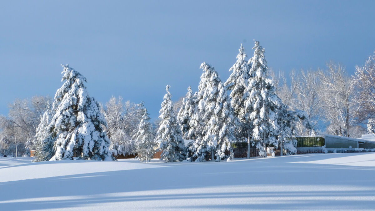
Spring storms bring needed moisture

Series: CSU Extension Boulder County | Story 19

One thing that many gardeners have in common is, they pay attention to weather. Especially precipitation levels here in the semi-arid west. So, it may come as no surprise to some of you that according to the U.S. Drought Monitor (https://droughtmonitor.unl.edu/), here, along the Front Range, we are currently experiencing drought conditions and in fact are in the 'Severe Drought' category.

While "drought is a normal part of the climate cycle", it is also characterized as "a slow-moving hazard" which needs to be paid attention to. When we go too long without significant moisture, it starts to become more serious. Given our current conditions, I was thrilled when the latest snowstorm came to fruition. Snow totals were less than originally predicted in some areas, but this storm brought a good amount of moisture to our parched landscapes.

Knowing that spring snow storms have the potential to dump a lot of heavy, wet snow, I wanted to learn a little more, so I contacted Seth Linden who is a software engineer at NCAR and has been doing weather as a career for 20 years.

Linden explained that in the spring we experience more energetic storms because there is a greater temperature contrast between the jet stream in the northern region, which is still cold, and the jet stream in the southern region, which is starting to warm up. This causes low pressure systems to intensify and when the two jet streams meet (often colliding right over Colorado), it results in stronger storms. Spring storms can produce heavy, wet snow because warmer air has more available moisture.

As these storms are building, they are sucking up that moisture from the warming southeast region and the snow that is created is wetter. If you think of snow that falls when it's really, really cold, it's often light and fluffy and doesn't hold a lot of moisture because it's produced from a polar air mass.

So what does this mean for our gardens? Snow ratios (percentage of water to snow) depend on how cold the air mass is that the snow was produced in, and the size of the flakes. The first half of this storm had very wet, dense snow and the second half brought lighter snow with big flakes and less moisture. Location reports vary and, as Linden put it, measuring snow totals is an art and a science, but overall, it's good news.

As reported from CoCoRaHS (Community Collaborative Rain, Hail & Snow Network) the Loveland/Berthoud area averaged 29 inches of snow, which equaled 3.5 inches of water when melted down; Longmont received 20 to 24 inches of snow with around 2.7 inches of water; and Boulder reports averaged 21 inches of snow with close to 2 inches of water. The result will be a nice slow release of moisture into the ground which will greatly benefit our landscapes.

The moisture came at a good time to start prepping gardens, but only after the soil dries out a bit and becomes workable. If you get into your gardens when soil is still too wet (read muddy), you run the risk of soil compaction which reduces the rate of water infiltration and generally makes your ground inhospitable to plants trying to spread their roots and grow. Will this much needed moisture get us out of drought conditions? Time will tell, but it will certainly help move us in the right direction.

Through my discussion with Linden, I learned that weather is fascinating and much more complicated to predict than I realized. I only scratched the surface in my exploration of spring snow. Weather dictates so much of our daily activities and it's something that affects everyone. After all, if you don't know what to talk about, you can always talk about the weather.

Weather resources: US Drought Monitor; CoCoRaHS, Seth Linden's public FaceBook group "Seth's Weather Report".


Reader Comments(0)