
All Local, All The Time
All Local, All The Time
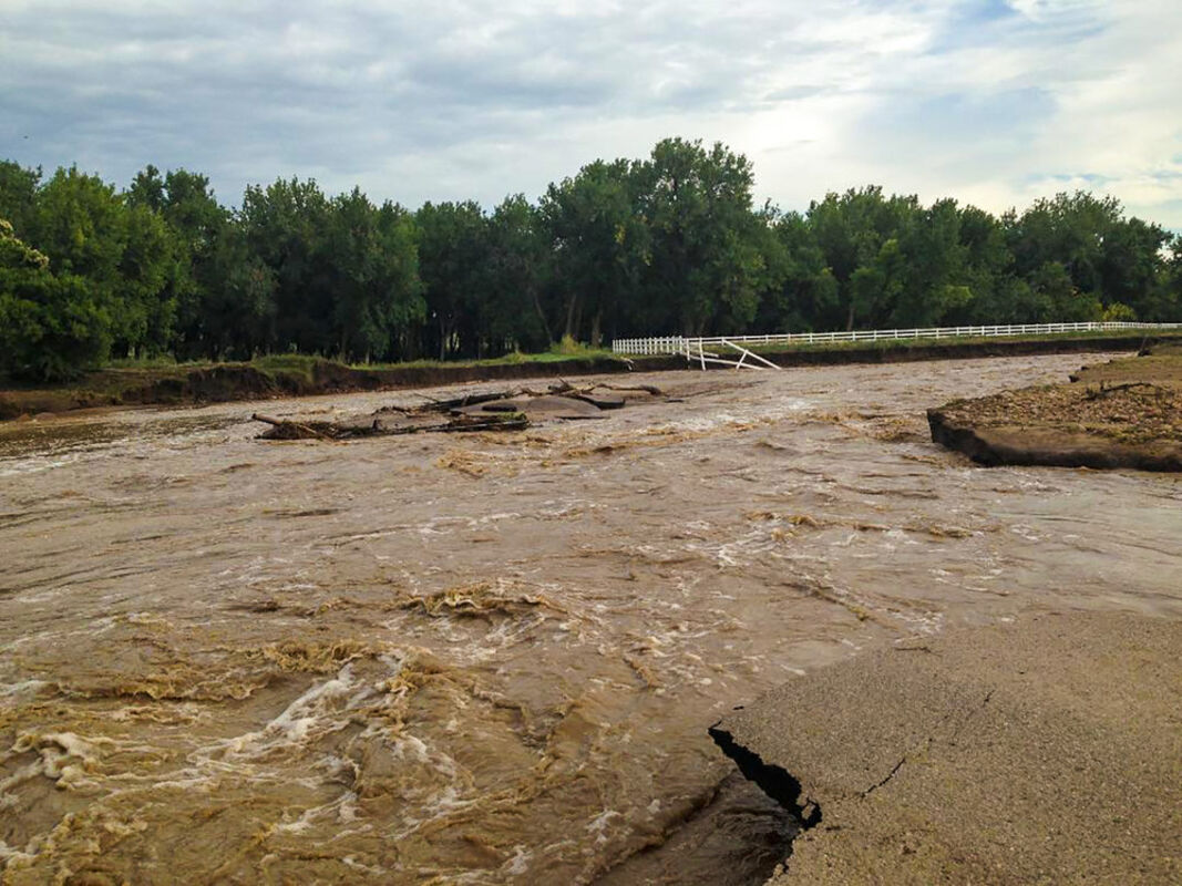
A river of water ran down Nimbus Road Friday, Sept. 13, 2013.
FEMA will soon be implementing new floodplain maps for Boulder County.
A move by the county last week to begin community review and appeals for the newly designated preliminary Flood Insurance Rate Maps (FIRMs) from FEMA is just one step in an ongoing process to reevaluate and replace the old, outdated floodplain maps in Boulder County.
In September 2019, the county came one step closer to approving new floodplain maps by adopting the preliminary FIRMS provided by FEMA. Those rate maps will be subject to an appeals process in the spring of 2020, and will be made effective some time in 2021 or later.
Once approved, "The flood insurance implications of that could be significant for people," according to Kelly Watson, the Floodplain Program manager at Boulder County.
The process is happening for two reasons: first, to update the old maps based on impact from the 2013 flooding, and second, the current, effective FIRMs are inaccurate.
Concerning the pre-2013 FEMA flood maps, Watson said in some cases "It was just bad mapping," especially up in the mountains. "Sometimes the floodplain was up on a hillside. It just wasn't very accurate."
The Colorado Hazard Mapping Program (CHAMP) was initiated and funded by the state after the 2013 flood, and run by the Colorado Water Conservation Board (CWCB), to address these issues. This process included several steps and phases, and was carried out not only in unincorporated Boulder County, but also in Weld County and other nearby areas.
During the CHAMP process, scientific surveys were conducted on land and with LIDAR (Light Detection and Ranging, a remote sensing method that uses lasers to measure distance and ranges), to create new topographic data. The history of flooding was taken into account.
This information was used to create new flooding models for the region, which were subsequently used to create new draft floodplain maps. At that point, Watson said, "The county did a whole bunch of outreach with draft maps and got feedback from residents and property owners in a series of meetings in 2017 and 2018."
Because of this process, Watson said, "These new CHAMP maps are much, much better in terms of their accuracy and in terms of reflecting the post-2013 conditions."
The county has been using the CHAMP mapping for permitting, however, the FEMA flood insurance rates have not yet changed, and won't change immediately. The timeline for adoption of new effective FIRMs could be 18 months or longer.
The new preliminary FEMA maps are largely consistent with the work that came out of the CHAMP process, and will continue to be edited to reflect ongoing restoration processes via a process called LOMR or Letter of Map Revision.
Approximately 1600 households, all of the properties that intersect the preliminary FIRMs, were notified via postcard in November of a public hearing related to the mapping process, and again this month regarding a public meeting in their area.
Six of these open house meetings were scheduled in January for property owners and residents to learn more about the FIRMS and the upcoming appeal process, which began on Jan. 14.
Community members from anywhere in the county are welcome to attend any of the remaining five sessions. Specific waterways will be the focus of each meeting.
The next meeting, which addresses the area in the Left Hand Valley of Saint Vrain Creek, Lower Left Hand Creek, Dry Creek #2, and Little Thompson River, is scheduled for Thursday, Jan. 16, in Longmont, from 5 to 6:30 p.m. A presentation will begin at 5:15 p.m.
Watson said, "We will have flood insurance experts from FEMA at the meetings, we'll have the engineers who worked with the state who actually made the maps to explain how the mapping occured, and then of course we'll have people from the county who can talk about how the county is going to run the appeals process, which is this 90-day period in the spring when the county is going to collect all these comments and forward them to FEMA."
The county will also provide the preliminary FIRMs for people both in paper and digital forms at the meetings. The maps are currently available on the county's website. Additional resources and information are listed at the end of this article.
The idea for these open houses, according to Wason, is "that we can review the flood insurance requirements and the appeals process" and answer questions from concerned citizens.
For more information contact Kelly Watson by email, [email protected], or call 720-564-2652, with questions about the Floodplain Remapping Program and the upcoming open houses. Details about the current process, the Colorado Hazard Mapping Program, the FEMA preliminary Flood Insurance Rate Maps, and more, can be discovered via http://www.BoCoFloodplainRemapping.com. Additional Open House meeting dates and times are available on the "How to Stay Informed" section of the website.


Reader Comments(0)